日本国产三级XXXXXX,亚洲人成网7777777国产,亚洲av无码专区色爱天堂老鸭,亚洲AV永久无码精品三区在线

CN
Home > Products > Hyperspectral Imaging Camera > Gaiasky-mini Hyperspectral Imaging Camera

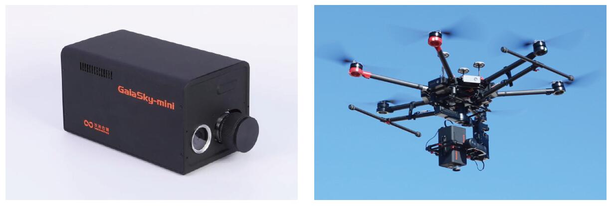
Gaiasky-mini

Gaiasky-mini Hyperspectral Imaging Camera

GaiaSky-VIS/NIR camera provide extremely high resolution images by scanning and taking multiple images to construct a hyperspectral datacube. Hyperspectral imaging devices (GaiaSky) for lens scanning obtain slit spectra by projecting a strip of the scene onto a slit and dispersing the slit image with a prism or a grating. In lens scanning, each two-dimensional (2- D) sensor output represents a full slit spectrum (x,λ). The NUC integrated into the system to control system operation ,data acquisition, and analyze , so the spatial dimension is collected through the scanning motor movement.
Inquiry
Download
Details
Gaiasky-mini Hyperspectral Imaging Camera
 
GaiaSky-VIS/NIR camera provide extremely high resolution images by scanning and taking multiple images to construct a hyperspectral datacube. Hyperspectral imaging devices (GaiaSky) for lens scanning obtain slit spectra by projecting a strip of the scene onto a slit and dispersing the slit image with a prism or a grating. In lens scanning, each two-dimensional (2- D) sensor output represents a full slit spectrum (x,λ). The NUC integrated into the system to control system operation ,data acquisition, and analyze , so the spatial dimension is collected through the scanning motor movement.
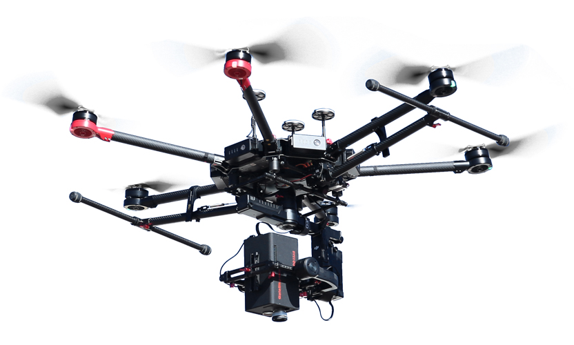
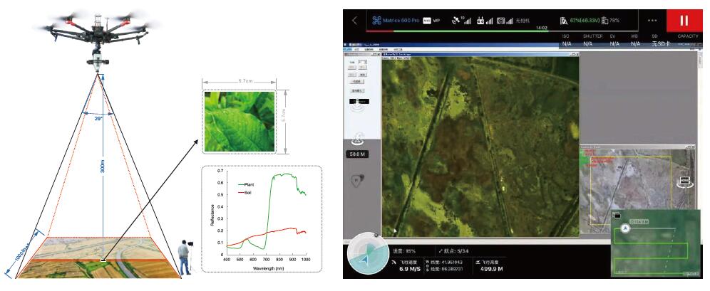
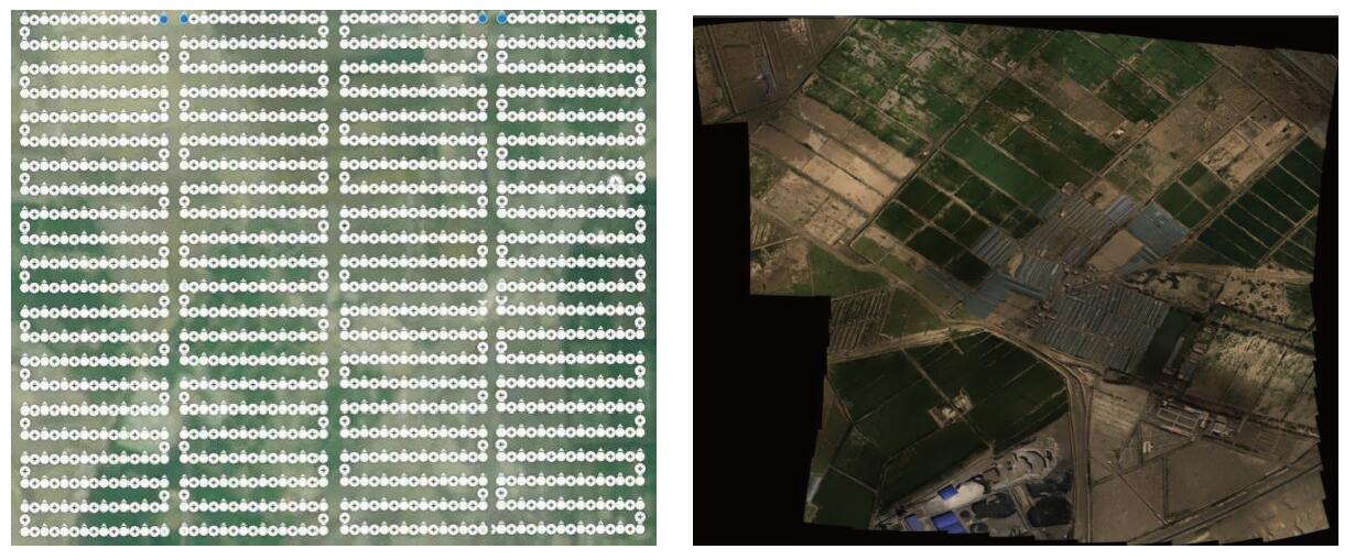
GaiaSky camera connects with DJ UAV, user only need control the UAV by controller fly to the test area and specific height, then the UAV receive the trigger signal from the operator, the system will work and save data to the internal NUC , when finish capture the first point so the UAV can automatically fly to next position which user set before fly until finish the last position collect.
 
GaiaSkySystem Function:
 Auto exposure time;
 Auto match scanning speed;
 Auxiliary camera (user can observe you want );
 Data analysis (reflectance /radiometric/uniformity/lens/area /atmospheric/calibration)
 Spectra /imaging view and export;
 Spectral Angle matching;
 NDVI(advance custom);
 PCA;
 Supervisedclassification;
 Support lens change;
 Standard type data (support envi/envice/matlab);
 Images stitching;
 

GaiaSky System Parameters 

Instrument model

Gaiasky-mini2-VN

Gaiasky-mini-VN

Gaiasky-mini-VN-W

Spectral Region(nm)

400-1000nm

Spectral resolution

3.5nm

Numerical Aperture

F/2.8

Spectral channel number

0.5nm

0.7nm

0.7nm

Pixels

1936 x 1456

4.54um

1392 x 1040

6.45um

1392 x 1040

6.45um

Pixel pitch

Digital OutPut

14(bit)

Signal Connector

USB 3.0

USB 2.0

USB2.0

Power

12~19V

Power Consumption

45W

Carrying platform

DJI M600 Pro

lens

18.5mm, 23mm

(FOVac,°)

26.7@18.5mm,21.5@23mm

27.3@18.5mm,22.08@23mm

27.3@18.5mm,22.08@23mm

The transverse view

142M@18.5mm,

115M@23mm(Flight altitude 300M)

146M@18.5mm,

117M@23mm(Flightaltitude 300M)

146M@18.5mm,

117M@23mm(Flight altitude 300M )

Ingle image resolution

1920X2080(1X), 960X1040(2X)

1392X1400(1X), 696X700(2X)

None

Spectral channel number

1440(1X),720(2X),360(4X),176(8X)

1040(1X),520(2X),256(4X),128(8X)

1040(1X),520(2X),256(4X),128(8X)

Spatial resolution

0.118(@23mm,Height 300m)

0.168(@23mm, ,Height 300m)

0.168(@23mm, ,Height 300m)

Scanning speed (line images/s)

125(360)

160(176channel)

60(360channel)

84(176channel)

60(360channel)

84(176channel

Single shotspeed (s)

9@360channel

7@176channel

13@360channel

9@176channel

None

Weight

1.5kg

1kg

Memory

240G SSD(512G,1T Optional)

 
GaiaSky System Apply:
There are many applications which can take advantage of hyperspectral imaging.
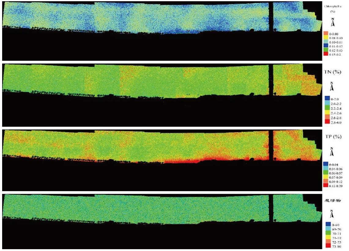
 Environmental: water quality monitoring, atmospheric monitoring of the Marine environment
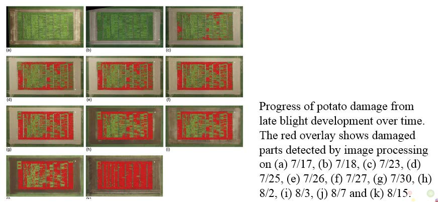
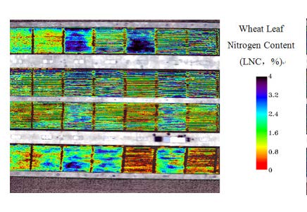
 Agricultural: plant disease feature classification agricultural census
 Military: anti-camouflage
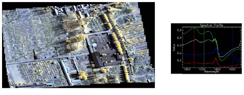
 Geological research: mineral exploration, basic geological survey, soil quality survey
Agricultural:
The application of hyperspectral in agricultural field is the most extensive and a relatively mature.It has a wide and far-reaching application prospect in the detection of crop growth classification diseases and insect pests and the investigation of forestry resources.The spectral characteristics of vegetation mainly depend on the chlorophyll content and composition in the leaves. Normally growing plants have typical spectral shapes.

Environmental:
The environment is becoming more and more prominent in modern society, but the traditional environmental monitoring methods cannot get the results quickly and in real time and the process is complicated.The spectral technology can effectively identify the sediment content and pollution concentration of water body and has unique effect on the investigation and monitoring of environmental problems.


Military:
In the military field is mainly in the near infrared and infrared spectral band.Gaiasky-mini2-VN is very good at detecting camouflage.

Geological research
Rock and mineral geological structure identification is an important application field of imaging hyperspectral system in geological exploration.Hyperspectral imaging technology also provides more abundant data for land survey and evaluation, which is of great significance to the management of land resource.